How Modified Satellite Photography Works [in Aerospace]
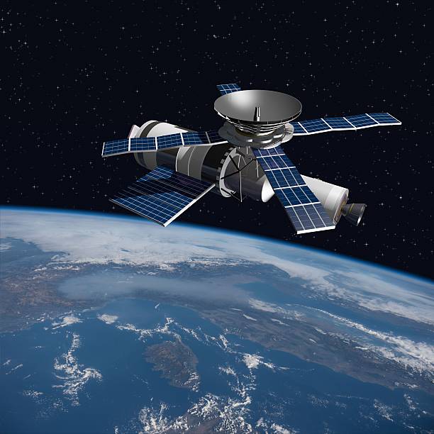
A modified version of Skylab - satellite laboratory for scientific experiments, orbiting over Italy - 3D Scene. Elements of this illustration furnished by NASA.
What is Modified Satellite Photography? Modified Satellite Photography also known as Modified Satellite Imagery or Remote Sensing, refers to the processing of raw orbital data to reveal insights invisible to the naked eye. It involves enhancing spatial resolution, applying false colors for analysis, or generating vector maps.
Key Modification Techniques and Applications
Super-Resolution (SR): Artificial Intelligence and Deep Learning models are used to upscale raw satellite images. Commercial services such as Airbus and Maxar use AI to effectively enhance resolution down to 15 cm, making features like roads and urban layouts much clearer.
Multispectral & False-Color Imaging: Satellites capture data across invisible bands of light, such as Near-Infrared (NIR) or Short-Wave Infrared (SWIR). By modifying how these bands are colored, analysts can evaluate crop health, monitor water quality, and even see through light mist or clouds.
Change Detection: Software tools overlay high-resolution historical images—dating back decades—to track changes in urban expansion, deforestation, and coastlines over time.
Platforms and Data Providers
Interactive Visualization: You can access live and historical data using platforms like EOSDA LandViewer, which allows you to apply built-in indices for vegetation and water, or the NASA Worldview tool for daily global snapshots.
On-Demand Imagery: Services like SkyFi let users task satellites and purchase custom high-resolution captures or videos for specific geographic areas directly from a smartphone or computer.
Spatial Platforms: Web tools like Apollo Mapping’s Image Hunter consolidate over 50 commercial and open-source sensors into a single search engine to locate specific aerial and satellite datasets.
Modified Satellite Photography, also known as Satellite Imagery or Space-Based Earth Observation, refers to the use of satellites in orbit around the Earth to capture images of the planet’s surface. In the context of aviation, modified satellite photography involves using satellite imagery to support various aspects of flight operations.
How Modified Satellite Photography Works
Satellites equipped with high-resolution cameras capture images of the Earth’s surface, which are then transmitted back to Earth. The images can be used to create detailed maps, track weather patterns, and identify features such as airports, runways, and terrain.
Modified Satellite Photography Techniques
Several techniques are used to modify satellite photography for aviation applications:
1. Orthorectification: Corrects for distortions caused by the satellite’s orbit and terrain, ensuring accurate representation of the Earth’s surface.
2. Pan-Sharpening: Combines high-resolution panchromatic images with lower-resolution multispectral images to produce high-resolution, color-corrected images.
3. ImageFusion: Combines images from multiple satellites or sensors to create a single, high-resolution image.
Applications of Modified Satellite Photography in Aviation
Modified Satellite Photography has numerous applications in aviation:
1. Airport and Infrastructure Monitoring: Tracks changes to airport infrastructure, such as construction or damage, and monitors runway conditions.
2. Weather Forecasting: Provides high-resolution images of weather patterns, enabling more accurate forecasting and flight planning.
3. Terrain Analysis: Helps pilots understand terrain features, such as mountains, valleys, and obstacles, to ensure safe flight operations.
4. Route Planning and Optimization: Enables airlines to optimize flight routes, reducing fuel consumption and emissions.
5. Disaster Response and Recovery: Provides critical imagery for disaster response and recovery efforts, such as assessing damage to airports and infrastructure.
6. Military Operations: Supports military aviation operations, such as surveillance and reconnaissance.
7. Environmental Monitoring: Tracks changes in environmental conditions, such as deforestation or pollution, which can impact aviation operations.
Benefits of Modified Satellite Photography
Modified satellite photography offers several benefits to the aviation industry, including:
1. Improved Safety: Enhances situational awareness and reduces the risk of accidents.
2. Increased Efficiency: Optimizes flight planning, reduces fuel consumption, and streamlines operations.
3. Cost Savings: Reduces the need for traditional aerial photography and surveying methods.
4. Enhanced Decision-Making: Provides accurate and timely information for informed decision-making.
Overall, Modified Satellite Photography has revolutionized the aviation industry, offering a powerful tool for improving safety, efficiency, and decision-making.


Tony is a Aviation, Aerospace and Airplane Geek. He specializes in Aeronautics, Avionics, Military Air Assets, Airliners and Airlines